Mostarska Bijela – Glacier Teardrops dissolved into Canyon and created a true Nature Wonder – One of the best hiking trails near Mostar
√ Mostarska Bijela is one of the most amazing hiking trails near Mostar
√ Explore the cave-alike 80 meters long canyon and amazing waterfall inside
√ It is great experience when traveling between Sarajevo and Mostar
√ The best time to explore Mostarska Bijela is later spring or early autumn
√ The tour is a cca 15km long, with very low altitude gain (around 300m) and is adjusted to any fitness level
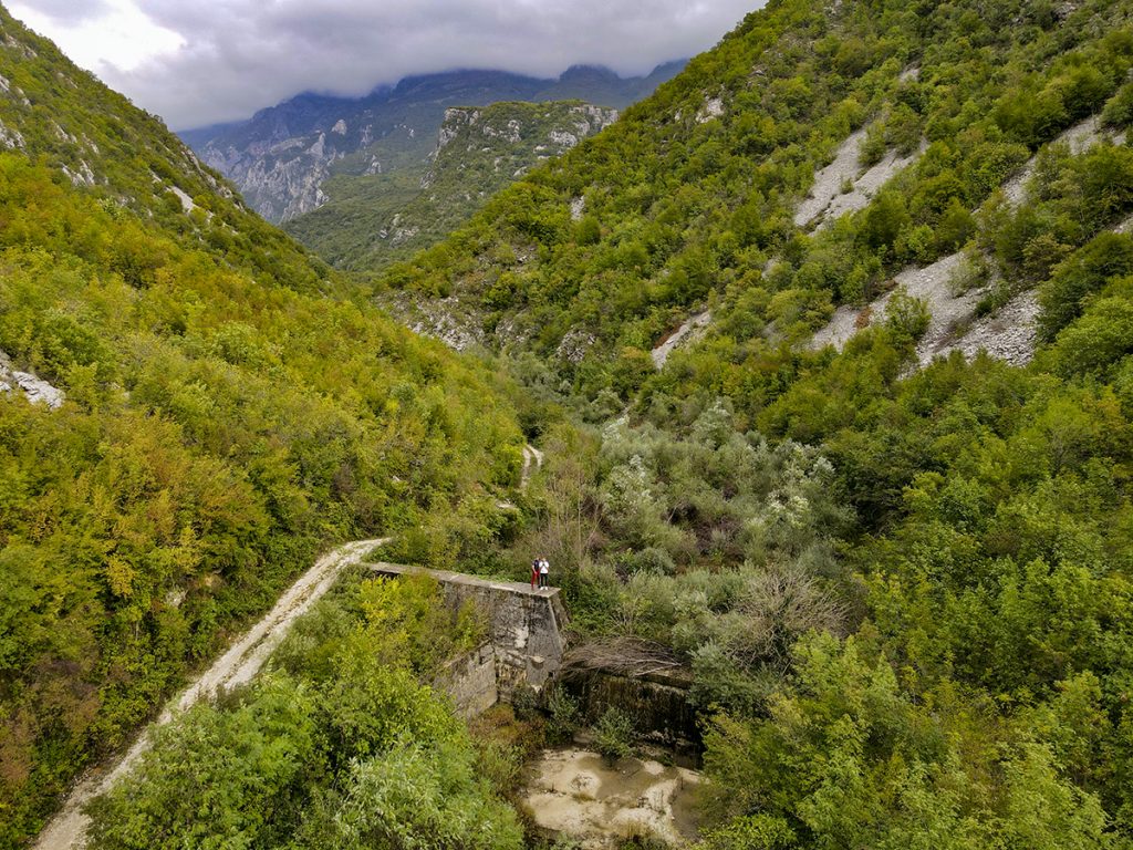
Twenty kilometres north from Mostar by M-17 Road to Sarajevo, at the left side of Salakovac Lake, where Mostarska Bijela (eng. Mostar’s White) river enters Salakovac lake, is the starting point of the spectacular 3-hour hiking trail to Mostarska Bijela River canyon.
Located at the bottom of glorious Prenj Mountain, Mostarska Bijela is the typical torrent flow.
Being at its water level peaks during the spring and early summer, the canyon is quite but not completely inaccessible. While for the rest of the year, when most of the river bed is dry, the Mostarska Bijela is offering an amazing opportunity to walk the trails of perfectly untouched nature, and explore the most amazing part of this natural wonder, the 80m long cave-like canyon of Bijela River with an amazing waterfall at the very end of the canyon.
Glaciologically, this valley starts at the western slopes of the glorious Prenj Mountain, where during the ice age, huge glacier was formed. Thousands of years later during the glacial movements and melting processes, where the starting point of the glacier was at around 1500m above the sea level, huge amounts of water were falling 1000m lower, and simply forming this amazing and wild valley.
The valley of Mostarska Bijela is around 6 km long, where in the upper flow there is a narrow, somewhere less than a meter wide, 1200m long canyon, of unimaginable beauty.
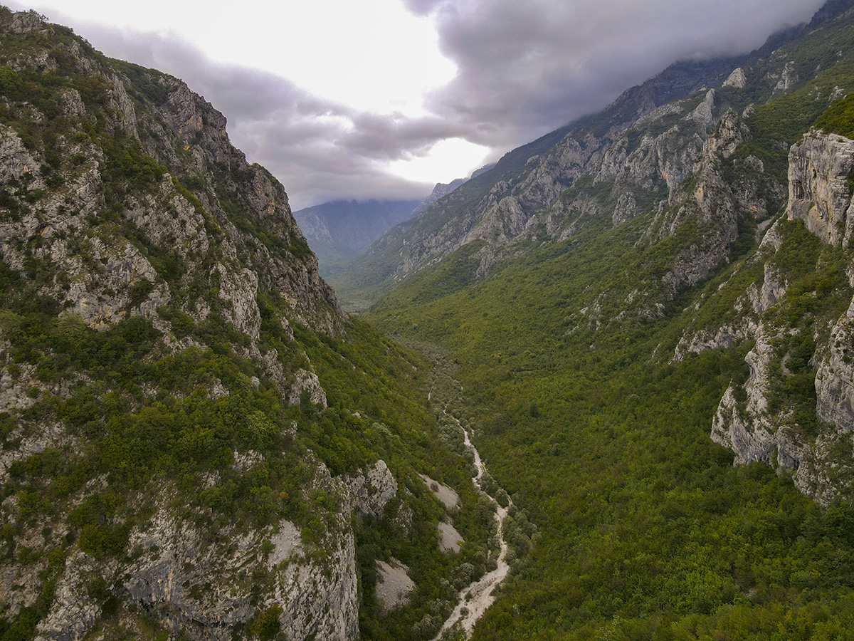
During the spring and summer months, the river flows through waterfalls, cascades and in places abysses of unimaginable beauty where only few people have ever stepped in. To pass the whole canyon itself, you need to have alpine climbing experience and a good set of equipment, along with a great guide.
The beginning of the trail where Mostarska bijela enters Neretva river accumulation called Salakovac, is locally called Pećina (eng. Cave). That is where we leave our car and start our one way, roughly 2.5 to 3h long hike.
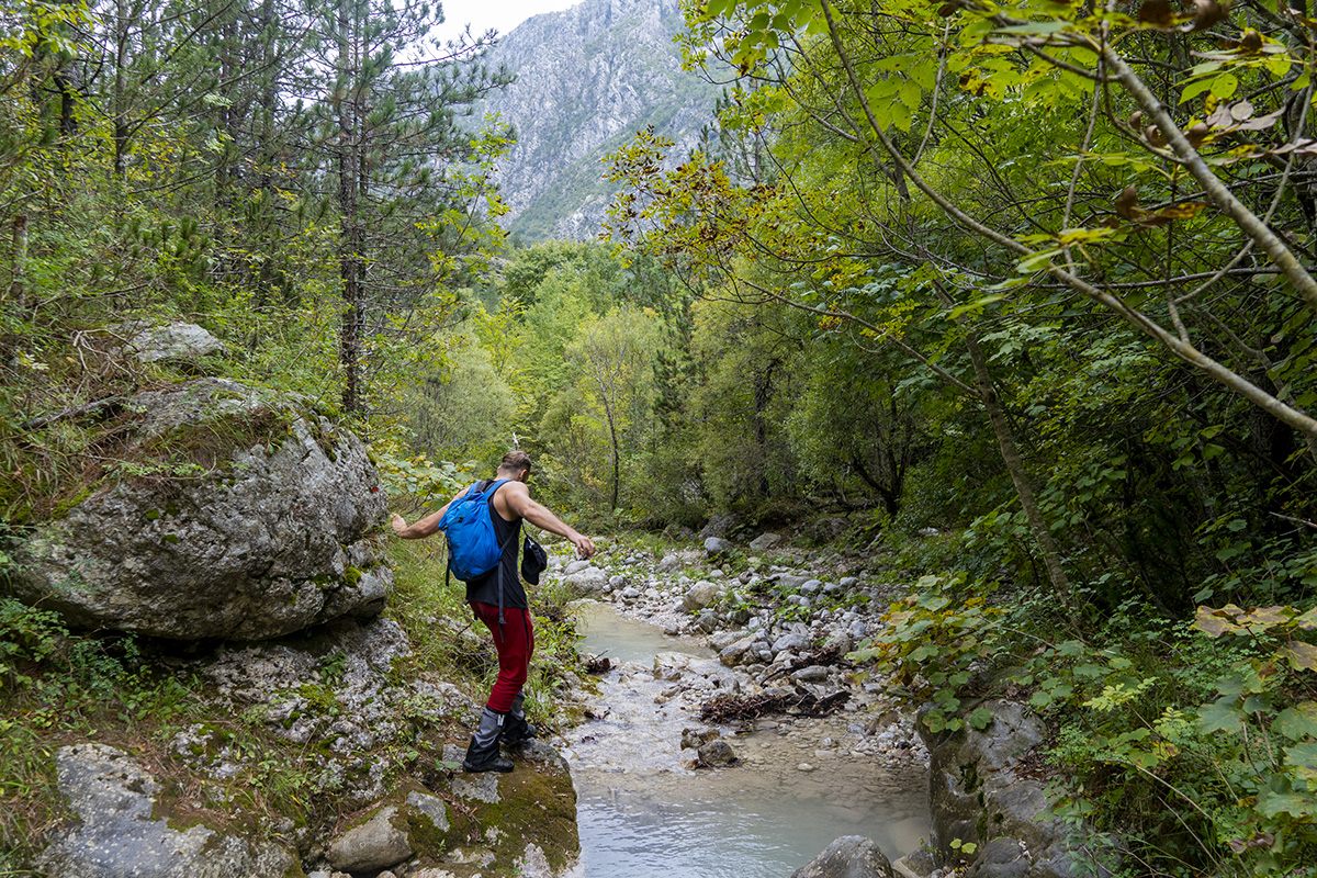
The trail takes us slightly higher, and we are passing by few concrete barrages created during the Yugoslavian days, to prevent major flooding and overaccumulation of the dirt and stone at the delta of Mostarska Bijela, entering Salakovac lake.
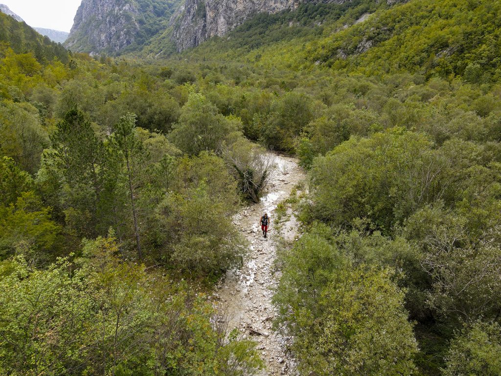
Later on, the trail is taking us through the wider region of Mostarska Bijela canyon. Depending on the season and river height, passing through this region requires us to jump over and cross the river several times. Attempting to cross the river at certain points without getting wet is completely an adventure of its own. Therefore, always keep in mind that regardless of the time of the year you plan to visit this stunning region, not getting wet will be quite an adventure.
During the 1990s Bosnian War, this trail was used to connect besieged Mostar and Jablanica town. It was a two day hike across the Prenj mountain, where thousands of people sought salvation from war and hunger.
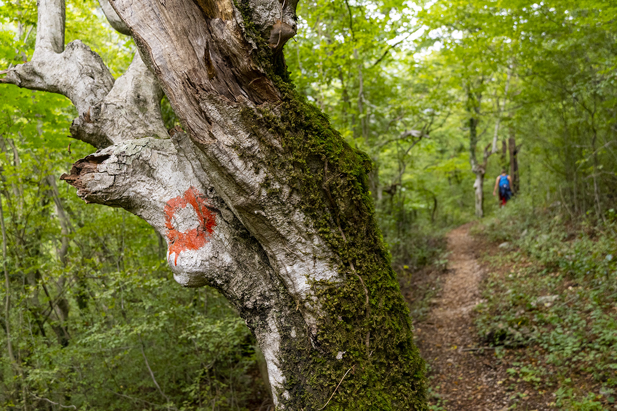
The last third of the trail is easy ascent through beautifully dense hornbeam and beech forest. The forest hides a lot of amazing rock formations, small side streams, animal wildlife, and few tree trunks so burned out and cut in half by the lightning, where you stop by and admire the sheer power of nature.
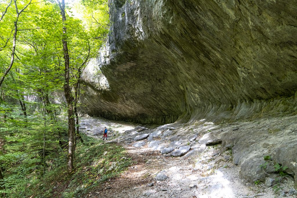
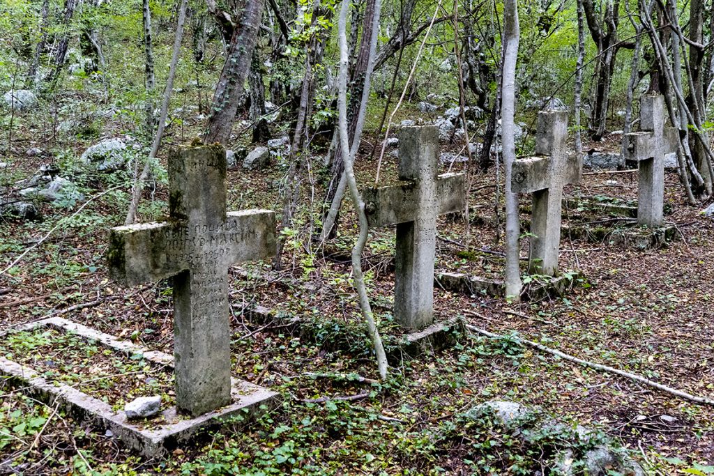
Passing by the ruin of one mountain lodge and next to the old, horror movies alike, 1920s cemetery of the natives Lojpur family, we reach another amazing set of rock formations called “Kravlje pećine” (eng. Cow caves).
The rock formation is an amazing place for shelter, which can host hundreds of people if needed. It is some 100m long limestone rock, looking like the giant frozen wave, where at its side-bottom are thousands of years old, beautiful, sometimes several meter high stalactite and stalagmite formations.
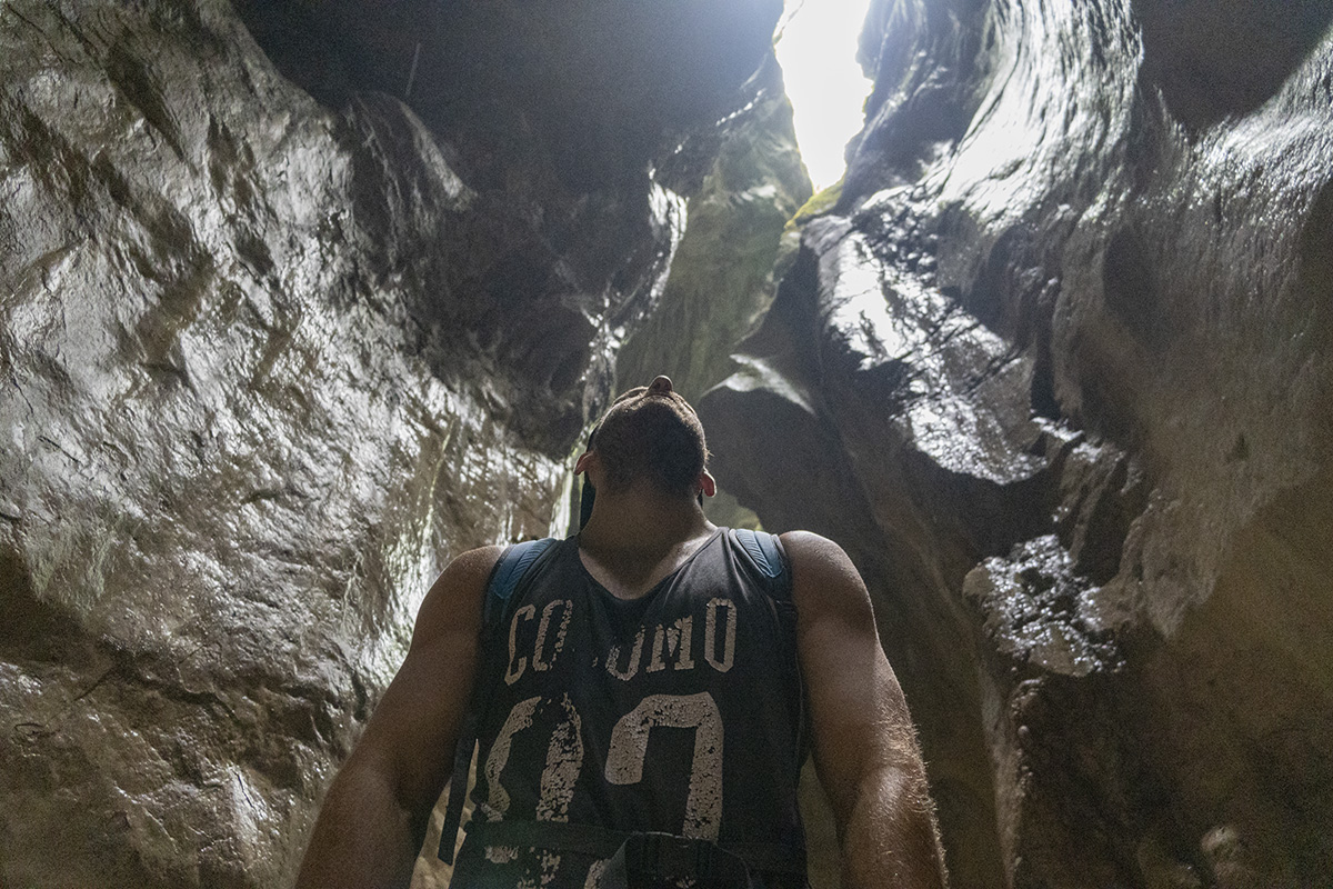
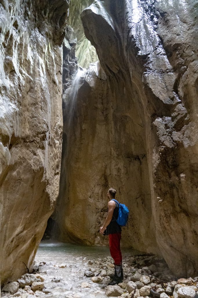
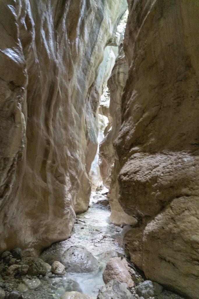
As soon as we leave caves behind, the canyon and the forest opens up and we reach our star of the day, the beginning of the 80m long cave-canyon of Bijela river.
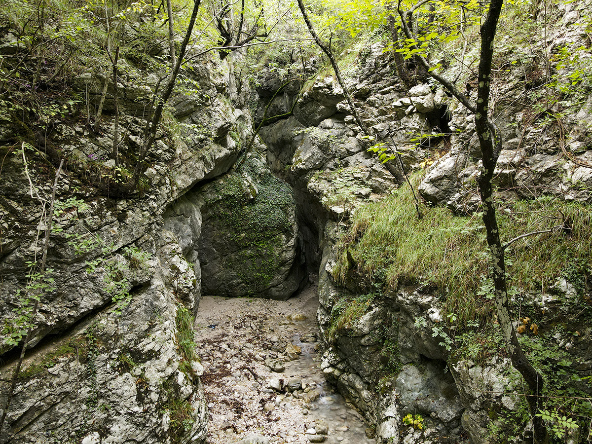
The cave is extremely narrow, at places being 1 metre wide and over 20 metre high, with Bijela river passing through. It is recommended if the water levels are high during the spring and post heavy rain periods, to have an extra pair of shoes or flip-flops to wear, in order not to get your hiking boots wet. Cave is cold and the water temperature is around 6-8 Celsius.
Cave being 80m long, is a 15-20 minute walk through the ice cold, crystal clear, drinkable water flow. Perfectly polished, non slippery rocks are quite easy to walk, and if you are an expert jumper, you can even avoid wet feet too. (But where is the fun then? Get wet and enjoy this amazing nature creation as much as you can!)
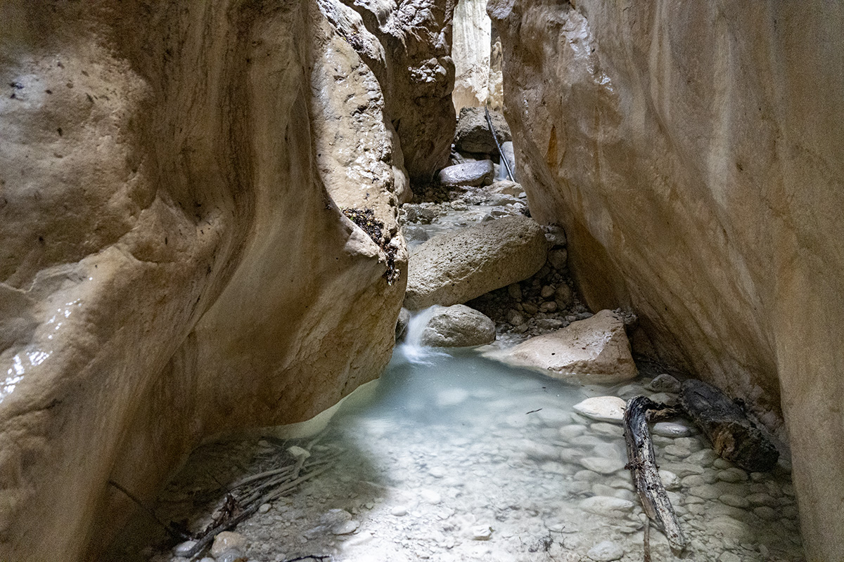
At the very end of the cave is a kind of, “heavens open” above us, 10m high waterfall. The water comes from higher parts of Prenj mountain and via these karst crafted holes, canyons and passages, eventually ending in the beautiful Neretva river. Upper flow of the river is not accessible beyond the point of the waterfall. At the very bottom the waterfall is river spring too.

Spending 30min to an hour inside the cave is recommended and stunning photos can be taken.
After an amazing time in the cave, reluctantly we decided, it is time to go back. After having a well deserved lunch by the Bijela creek just outside the cave, we took a 2.30 hours hike back.
Roughly half-way back, there is a left turn towards one of the most amazing peaks of Prenj mountain, called Lupoglav. During the summer time long days, roughly 8 hours hike can take you from our starting point at 70m asl to Lupoglav at 2012m asl. Amazing experience for fit travellers.
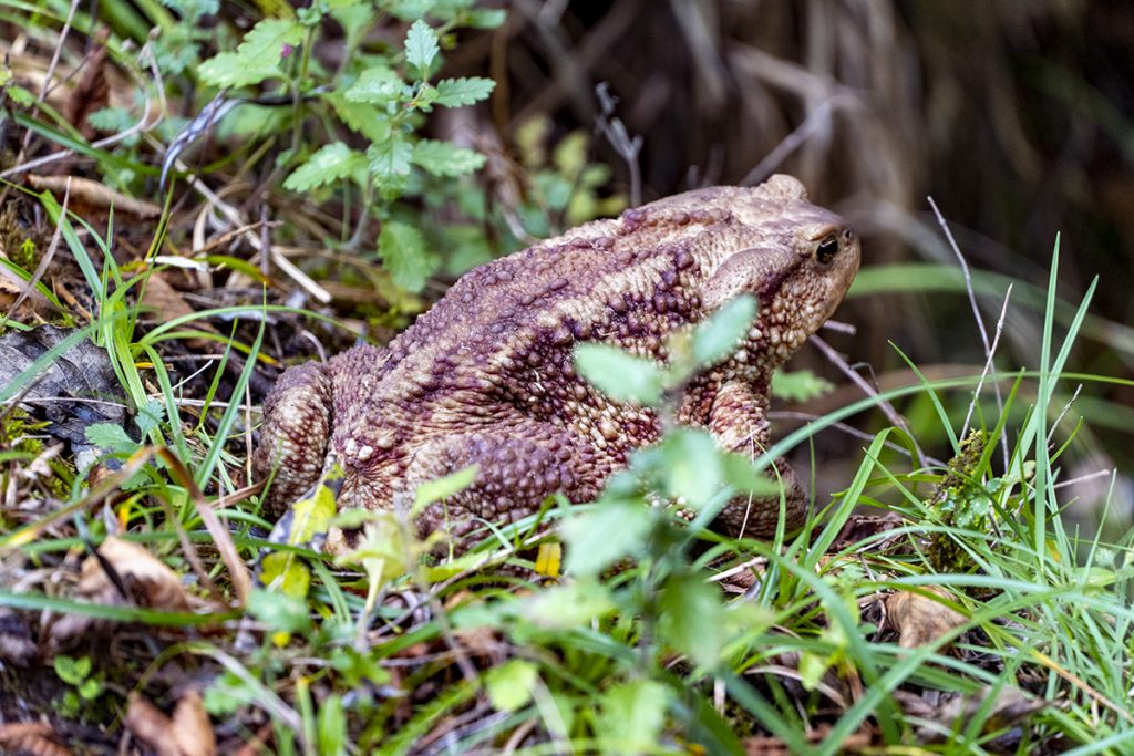
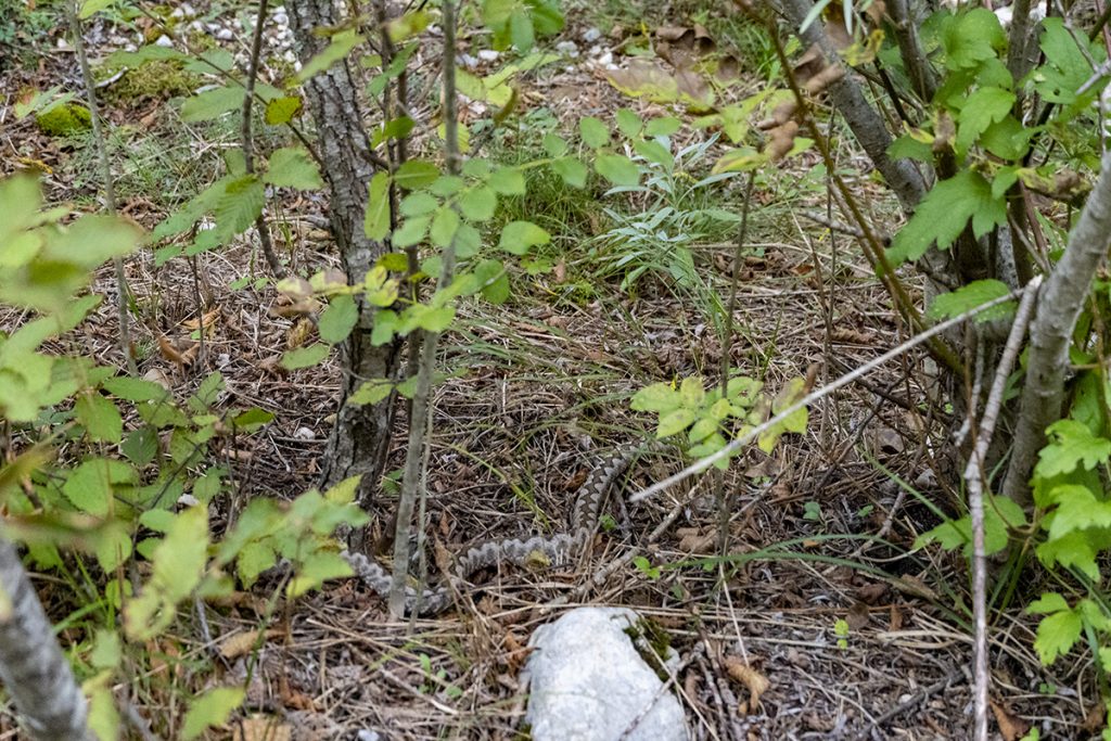
During the walk animal wildlife is so easy to spot. We had an amazing chance to meet up with viper snakes (Vipera ammodytes) and several types of differently sized frogs and lizards. The region is known to be home for chamois, wild horses and eagles, with stunning biodiversity of herbs and trees.


")


")


 – Kosovo")